
DEEPAK VERMA - Department of Civil Engineering, Indian Institute of Technology, Roorkee
A group of Ph.D. scholars from IIT Roorkee and Master’s students from the Institute of Environmental Sciences and Geography, University of Potsdam, along with esteemed professors from both institutes, started this adventure and knowledge full journey of India Himalayas scheduled from 10th to 16th October 2024 in this year. During this whole journey, we experienced incredible nature and the beautiful snow-covered peaks of the Himalayas. In terms of knowledge sharing on this trip, we had preplanned field presentations on different themes of natural hazards of the Himalayas and scientific talks by the students and professors. In the following paragraphs, I will share my experience and day-wise activities during the field school.
Day One: 10 October, Roorkee to Srinagar
In the early morning of 10th October, we started our journey from IIT Roorkee to Srinagar. During this journey, we had a small stop at the Goa Beach of Rishikesh near the bank of Ganga, where Dr. Jürgen Mey gave a talk on the ‘Tectonic and Geology of the Himalayas’ (Fig.1), and after the talk, we had lunch. Our next stop was the Devprayag confluence, the place of merging of two visible heavenly rivers, Alaknanda and Bhagirathi, to form the holy Ganges. Here, we visited one of the river monitoring stations of the Central Water Commission (CWC) of India, where we conducted some scientific experiments (Fig. 2) on river flow measurement using different instruments and methods. Finally, before sunset, we reached Srinagar.
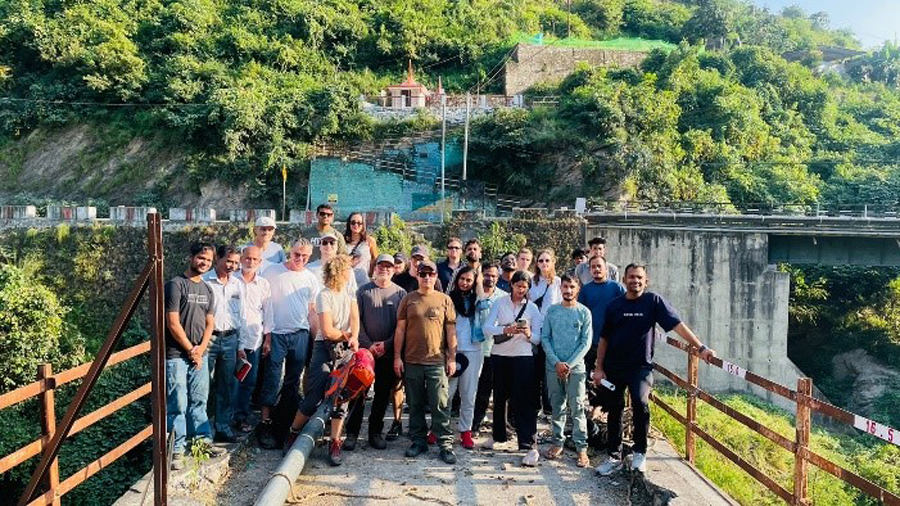
Figure 2: Devprayag CWC Station
We ended today’s journey with a small talk on ‘Tourism, pilgrimage and natural hazards & quaternary climate change and landscape evolution’ (Fig. 3) by Prof. Roopam Shukla.
Day Two: 11 October, Srinagar to Badrinath
On day two, we had to travel approximately 185 km from Srinagar to Badrinath, so we started our journey from Srinagar in the early morning, just after breakfast. We had small stops for sightseeing and food during the travel because we took a whole day to reach Badrinath. In the evening, Prof. Saurabh Vijay gave a small talk on the Glacier in the Himalayas.
Day Three: 12 October, Hike to Satopanth glacier terminus via Vasudhara Falls
On day three, we trekked to Vasudhara waterfall (Fig. 4) and Satopanth Glacier terminus (Fig. 5). Here we experienced a real trekking adventure in the Himalayas, Natural water streams, Waterfall, snow-covered peaks of the Himalayas, Glacier, and hanging glacier. During this trek, we discussed the different features of glaciers near the Satopanth Glacier and the geological process behind the formation of different rock structures, V-shaped valleys, and U-shaped valleys. We had seen different debris cones formed due to streams from snow-covered peaks. To understand climate change and elevation-dependent warming and its effects on the glaciers of the Himalayas, Mr. Kilian Lenz talked about ‘Climate change and elevation-dependent warming’. Near the terminus of Satopanth, we had another field talk by Miss. Marlene Kroschel talked about the ‘Different vegetation zones in the Himalayas’ and discussed how vegetation changes at different altitudes of the Himalayas.
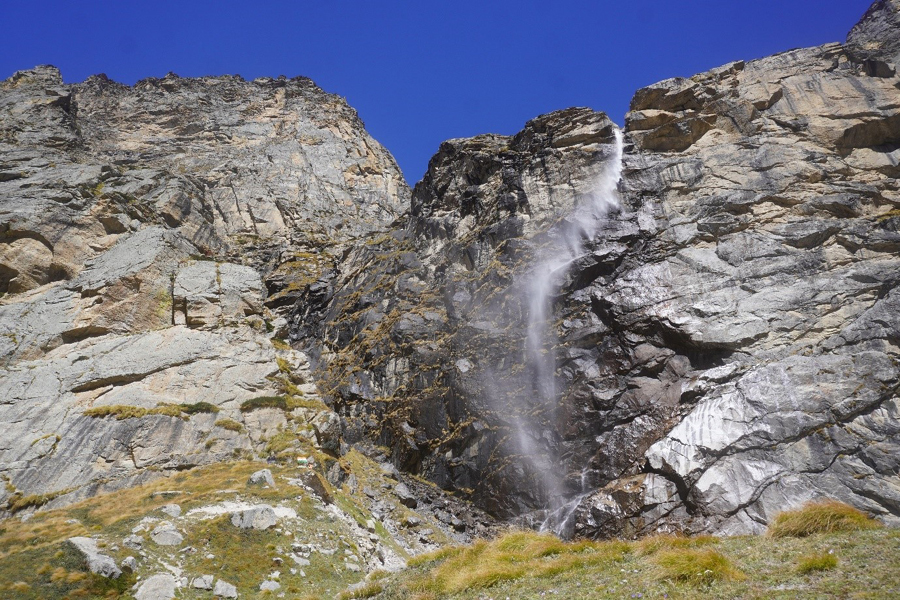
Figure 4: Vasudhara Waterfall, Uttarakhand, India.
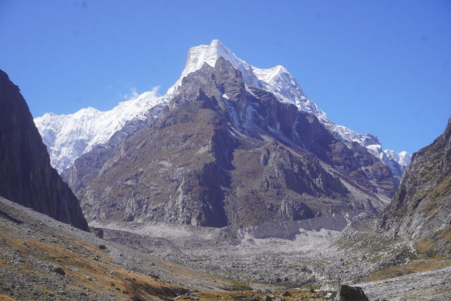
Figure 5: Terminus of Satopanth Glacier, Uttarakhand, India
Day Four: 13 October, Badrinath to Joshimath
After Satopanth Glacier's visit, on day four, we visited the Badrinath hydropower project constructed in the Rishi Ganga River (Fig 6). It has a power generation capacity of 2 X 625 kilowatts, using the Francis turbines with a hydraulic head of 75.45 m. To achieve this hydraulic head, a water diversion structure was constructed 440 m away from the powerhouse in the uphill. We had to leave today for Joshimath, so we returned to the hotel just after a small trek on the uphill side of the Badrinath hydropower project. In the Vishnuprayag, a confluence of India's Alaknanda and Dhauliganga rivers, we had a small stop to see the traces of the Chamoli disaster Dhauliganga flood (Fig. 7) happened in 2021 due to the Glacial Lake Outburst flood (GLOF).
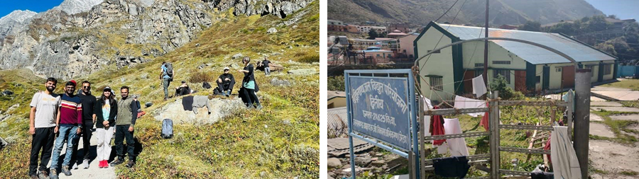
Figure 6: Visit of Badrinath hydropower project constructed in the Rishi Ganga River
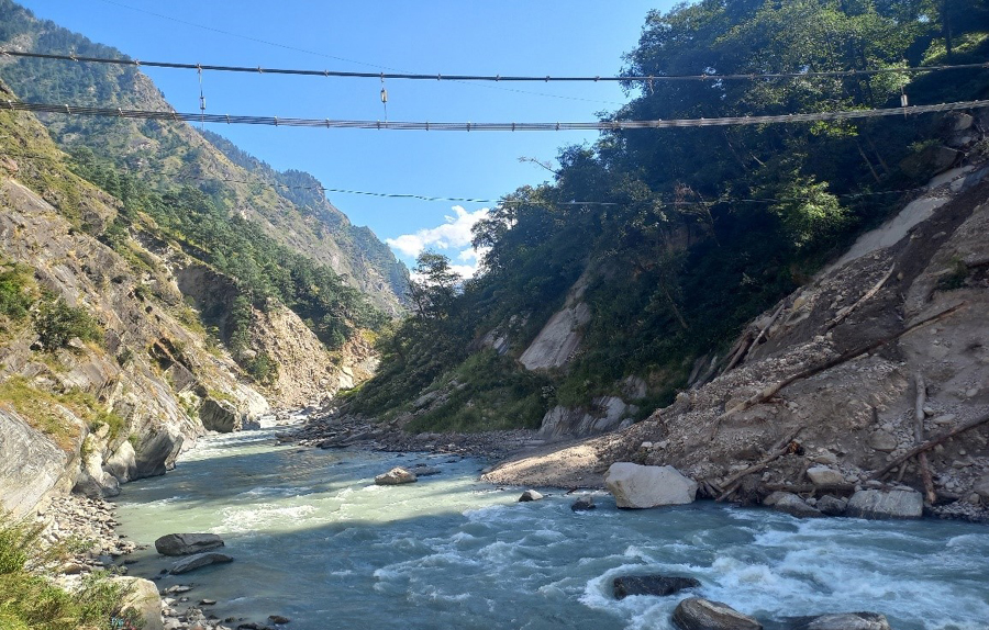
Figure 7: The Chamoli disaster Dhauliganga flood happened in 2021 due to the Glacial Lake Outburst flood
This region is surrounded by the Nanda Devi Biosphere Reserve and Nanda Devi National Park, a UNESCO World Heritage Site in the outer Garhwal Himalayas in Uttarakhand state, India. In the evening, we had a video lecture streaming "Joshimath Town Sinking: An Insight from field-based analysis" of the Udan series by Prof. Ajanta Goswami. After the lecture, I (Mr. Deepak Verma) showed some of my findings on Joshimath Subsidence time series analysis using IPTA InSAR. This is how our day four ended.
Day Five: 14 October, Dhauliganga landslide destroyed Rishiganga HPP, Chamoli event, Visit Tapovan dam
In the early morning, after breakfast, we started our journey towards the destroyed construction site of Tapovan Dam and Rishiganga HPP in Dhauiganga River due to Chamoli Disaster (Fig 8). In the Dhauiganga Riverbank, we had field observations based on geomorphological feature identification exercises along the riverbank and plotted their symbolic location on chart paper.
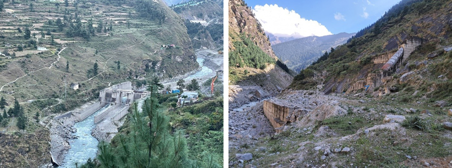
Figure 8: Tapovan Dam and Rishiganga HPP in Dhauiganga River due to Chamoli Disaster
After this exercise, we visited a small village, Bhalagav and Suki (Fig. 9), situated 30 km from Joshimath town in the northeastern direction. Here, we had a detailed conversation with the local villagers about their lives in this remote village in the Himalayas. We observed their outstanding living strategy, farming practices, Horticulture, animal husbandry, and water conservation arrangements for daily use. During lunchtime, Mr. Moritz Everwien gave a talk on ‘Extremes and Climate Change’ in the Suki village. During the return from Suki village, our next destination was the under-construction Tapovan dam and Rishiganga HPP site, which was destroyed during the Chamoli GLOF event in February 2021. in this event, a total of 204 people died, of which 124 dead bodies are still missing. Here, we explored nearby areas affected by the flood and found terraces of fluvial deposits due to the flood; near the Tapovan dam site, Miss Nell Wassermann gave a field talk about the ‘2013 Uttarakhand Flood’. This day ended with a presentation by Miss. Nagashree about the ‘forest fire in Uttarakhand’, and we had a small party in the evening to celebrate this successful trip.
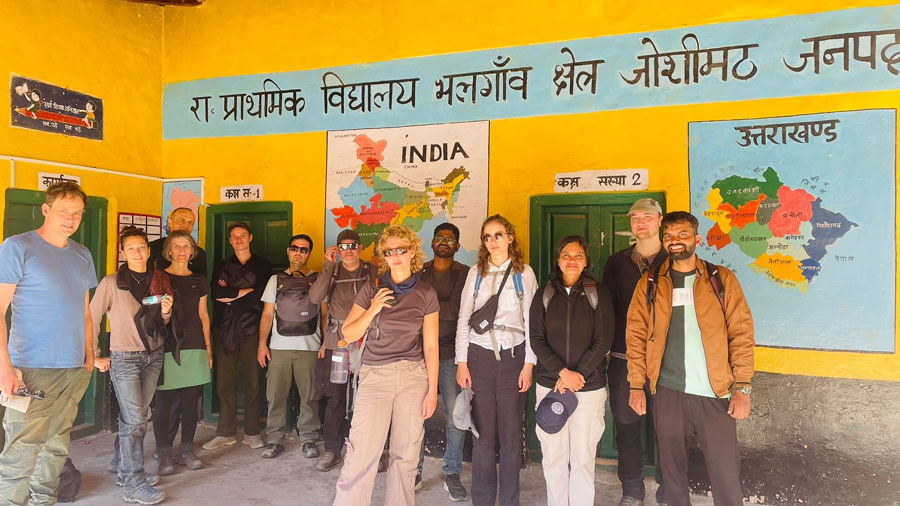
Figure 9: village Bhalagav and Suki, Uttarakhand, India
Day Six: 15 October, Joshimath to Tehri
On day six, we had to travel a long way, approximately 230 km, from Joshimath to the Tehri Dam site. Therefore, our entire day was spent traveling. Although the Tehri Reservoir is spread over 52 Square kilometers and has a total water storage capacity of 3.54 cubic kilometers, we have a small stoppage to see Tehri Lake when we are approaching the Tehri Dam site. After the full day of the journey, we reached our destination in New Tehri town, where Mr. Abhinesh G. and Mr. Nishant Saxena had presented their research work. In the last, I (Mr. Deepak Verma) presented my research work on the ‘Hydropower and Energy Security’ theme.
Day Seven: 16 October, Tehri to Roorkee
Our Tehri dam visit was very uncertain because of the security issue. Finally, we got permission to visit the Tehri Dam site, chute spillway, and power generation unit. This is a multipurpose Rock and Earth-fill embankment dam with a total height of 855 ft. It is the tallest dam in India and the 13th tallest dam in the world. Currently, this dam has a total of 1000 megawatt power generation capacity. Security personnel asked us to leave our bags and phones in the cars when we entered the dam site because of security concerns; photography is completely restricted in this area. A group of Tehri Hydropower Development Corporation (THDC) India Limited officers and engineers briefed us about the dam operation and its history. After the introduction, we visited the Tehri Dam Museum, where we saw some old pictures of the Tehri Lake and the Dam site before the construction. Finally, dam authority officials took us to a power generation unit where they explained the power generation and transmission process to us. Here, we have seen the penstock and turbine unit. With the Tehri dam visit, we completed the visit to the final destination of this Co-Prepare Field School 2024 and started our journey to Roorkee; on the evening of day seven, we returned to the Roorkee Campus. This was an unforgettable experience that we have experienced during the whole Co-Prepare field School 2024.